Quick Answer
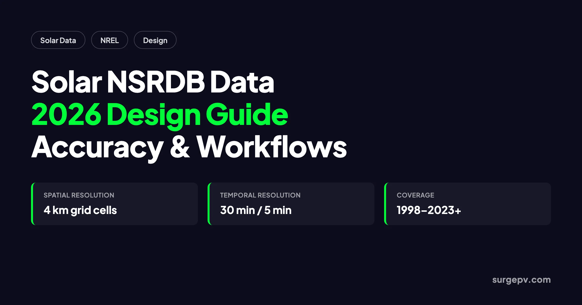
The National Solar Radiation Database (NSRDB) is NREL's free, satellite-derived solar resource dataset. It provides GHI, DNI, DHI, temperature, wind, and other meteorological variables at 4 km spatial and 30-minute temporal resolution, with 5-minute/2 km data available for the US from 2019. Solar designers use it to size arrays, estimate yield, and validate production models.
A 500 kWp rooftop in Phoenix and an identical system in Seattle can differ by more than 40% in annual production. The single input driving that gap is solar resource data. For most US solar designers, that data comes from one source: the National Solar Radiation Database.
NREL’s NSRDB powers PVWatts, SAM, and the majority of commercial solar design platforms used in the United States, including SurgePV’s solar design software. It is free, serially complete, and updated annually. Yet many designers treat it as a black box. They enter an address, accept the default weather file, and move on without understanding the resolution, uncertainty, or limitations baked into the numbers.
That gap matters. A 5% error in irradiance translates directly into a 5% yield error. On a commercial project, that can shift payback by a year or more. This guide explains what solar NSRDB data actually contains, how it is produced, where it is accurate, where it falls short, and how to use it inside modern solar design workflows.
In this guide:
- What the NSRDB is and which datasets it offers in 2026
- The solar radiation components and meteorological variables included
- How NSRDB data moves from satellite imagery to energy yield output
- Accuracy benchmarks and real limitations designers should know
- How to access and download NSRDB data for a project site
- Where SurgePV’s calculators and design automation fit into the workflow
Quick Answer
The National Solar Radiation Database (NSRDB) is NREL’s free, satellite-derived solar resource dataset. It provides GHI, DNI, DHI, temperature, wind, and other meteorological variables at 4 km spatial and 30-minute temporal resolution, with 5-minute/2 km data available for the US from 2019. Solar designers use it to size arrays, estimate yield, and validate production models.
What Is the NSRDB and Why Solar Designers Use It
The National Solar Radiation Database (NSRDB) is a collection of solar irradiance and meteorological time-series datasets maintained by the National Renewable Energy Laboratory (NREL). It is the default solar resource input for most US solar design, simulation, and financial modeling tools.
The modern NSRDB is built from satellite imagery rather than ground station networks. Earlier versions relied heavily on airport weather observations. The current Physical Solar Model (PSM) uses geostationary satellite radiance measurements, physical radiative transfer models, and reanalysis data to produce continuous coverage across the United States and an expanding set of international locations.
Designers use NSRDB data for four core tasks:
- Site screening — Compare resource quality across candidate locations before detailed design.
- System sizing — Convert irradiance into expected kWh/kWp for module and inverter selection.
- Energy yield modeling — Feed hourly or sub-hourly data into simulation engines for P50/P90 analysis.
- Financial forecasting — Link production estimates to savings, payback, and IRR calculations.
Because NSRDB is free and covers the entire US with consistent methodology, it removes the cost barrier that used to force small installers to guess resource values from regional maps. A designer in Boise can run the same quality of analysis as a bankable engineering firm in New York, at least for the initial design stage.
The database is updated annually. As of the 2024 NSRDB release, the core PSM record covers 1998-2023. NREL continues to refresh older years when model improvements are released, so the historical record is periodically reprocessed rather than frozen. This is important for long-term yield studies: the 1998 data you download today may have been recalculated with a newer algorithm than the same year downloaded five years ago.
NSRDB Data Products and Resolution in 2026
Not all NSRDB files are the same. The database contains several products with different spatial coverage, temporal resolution, and intended use cases.
Physical Solar Model Version 3 (PSMv3)
PSMv3 is the standard NSRDB product most designers encounter. According to the NREL NSRDB catalog entry on Data.gov (2024), it provides:
- Coverage: United States, Americas, parts of Asia-Pacific, and India
- Spatial resolution: 0.038 degrees latitude/longitude, nominally 4 km × 4 km
- Temporal resolution: 30 minutes
- Time period: 1998-2023
The 4 km grid is small enough to capture broad geographic differences, such as the rain shadow east of the Cascade Range or the elevation gradient between Denver and the plains. It is not fine enough to resolve a single rooftop shaded by a neighboring building or a narrow coastal fog band.
GOES-R 5-Minute and 2 km Data
From 2019 onward, NREL provides enhanced NSRDB output over the United States using next-generation GOES-R satellite data. The ESIG Weather Dataset Needs report (2023) notes that this product offers:
- Spatial resolution: 2 km × 2 km
- Temporal resolution: 5 minutes
The higher cadence matters for distributed solar studies, battery dispatch modeling, and grid interconnection analysis where ramp rates and short-term variability affect export limits or storage cycling. It is overkill for a simple residential production estimate, but valuable for commercial and industrial projects with time-of-use rate structures.
Typical Meteorological Year (TMY)
TMY datasets are synthetic one-year files built by selecting representative months from the multi-year PSM record. They are designed for standardized system comparisons, not for capturing interannual variability. If you are comparing two inverter topologies or two module technologies at the same site, TMY is appropriate. If you are building a P90 bankability case, use the full PSM time series. PVsyst’s NSRDB import documentation describes how TMY and multi-year files are handled in professional simulation workflows.
India and International Extensions
NREL has expanded NSRDB coverage beyond the United States using region-specific satellite inputs. The SUNY model covers South Asia at roughly 10 km resolution for 2000-2014. PSMv3 has also been produced for parts of Asia, Australia, and the Pacific. Coverage and resolution vary by region, so international projects should verify which product is available for the specific coordinates.
| Product | Coverage | Resolution | Best For |
|---|---|---|---|
| PSMv3 | US, Americas, parts of Asia-Pacific | 4 km, 30 min | General solar design and yield analysis |
| GOES-R | United States (2019+) | 2 km, 5 min | Storage, ramp-rate, and TOU studies |
| TMY | US and select international | 1 year synthetic | Equipment comparison and standardized modeling |
| SUNY | South Asia | ~10 km, 60 min | Preliminary resource screening in India |
Version History and Reprocessing
The NSRDB has moved through several major versions. The original 1961-1990 dataset covered 239 US stations with modeled and measured data. The 1991-2005 update expanded coverage but still relied heavily on meteorological observations. The modern PSM era began around 2012, bringing satellite-derived irradiance and much finer spatial resolution.
NREL periodically reprocesses the entire historical record when models improve. For example, the shift from PSM v2 to v3 brought changes in cloud property retrieval, aerosol handling, and time-shifting methodology. This means a 2005 weather file downloaded today may not match the same year downloaded in 2018. For most designers, the newer version is better. For long-term portfolio analysis, consistency across projects matters more than using the absolute latest version, so document which release you used.
What Variables Are Included in NSRDB Files
A solar designer does not just need irradiance. Temperature, wind, and albedo all affect real-world performance. NSRDB provides a bundled set of variables that allow complete PV simulation without searching multiple sources.
Core Solar Irradiance Components
The three fundamental irradiance values are:
- GHI (Global Horizontal Irradiance): Total solar radiation on a horizontal surface, including direct and diffuse components.
- DNI (Direct Normal Irradiance): Direct beam radiation perpendicular to the sun’s rays.
- DHI (Diffuse Horizontal Irradiance): Scattered radiation on a horizontal surface from the sky dome, excluding the direct beam.
These three are related by the equation:
GHI = DHI + DNI × cos(zenith angle)
If your simulation tool asks for GHI only, it internally decomposes GHI into DNI and DHI using a decomposition model. If you have access to all three components directly from NSRDB, you can skip that estimation step and reduce one source of uncertainty. See our solar irradiance GHI DNI DHI guide for a deeper explanation.
Meteorological and Ancillary Variables
NSRDB also provides:
- Air temperature
- Dew point
- Relative humidity
- Wind speed and direction
- Surface pressure
- Precipitable water vapor
- Aerosol optical depth (AOD)
- Surface albedo
- Solar zenith angle
- Cloud type and cloud optical depth
- Fill flags indicating missing or gap-filled data
Temperature feeds directly into module temperature and power derating. Wind speed affects convective cooling of the array. Albedo matters for bifacial gain estimates. Aerosol optical depth helps explain why some desert sites show lower production than raw irradiance would suggest.
How NSRDB Data Flows Into Solar Energy Calculations
The NSRDB pipeline transforms raw satellite measurements into usable design inputs through several modeling steps. Understanding this chain helps designers judge when the output is trustworthy and when it needs ground validation.
Step 1: Satellite Cloud Detection
The process starts with geostationary weather satellites, primarily the GOES series for the Americas. The PATMOS-x algorithm developed by the University of Wisconsin identifies cloud properties, including cloud type, optical depth, and effective radius, from half-hourly visible and infrared radiance images.
Step 2: Clear-Sky and Cloudy-Sky Radiation Modeling
For clear-sky conditions, NSRDB uses the REST2 radiative transfer model to compute GHI and DNI. REST2 accounts for aerosols, water vapor, ozone, and other atmospheric constituents.
For cloudy skies, NSRDB uses the Fast All-sky Radiation Model for Solar Applications (FARMS). FARMS combines satellite cloud properties with atmospheric profiles to estimate GHI under cloud cover. DNI in cloudy conditions is derived using the DISC model or, in more recent implementations, FARMS-DNI, a physics-based approach that reduces the historical overestimation of direct beam under overcast skies.
Step 3: Ancillary Data Integration
Variables such as aerosol optical depth, precipitable water vapor, temperature, wind, and surface albedo come from NASA’s MERRA-2 reanalysis dataset. These inputs fill gaps that satellite radiance alone cannot resolve, particularly aerosol loading and atmospheric moisture.
Step 4: Time-Series Output for Simulation Tools
The final product is a gridded time series that simulation tools ingest. PVWatts uses NSRDB data to estimate annual production in seconds. SAM allows more detailed configuration. SurgePV and other design platforms call NSRDB or similar datasets in the background when a designer enters a site address, then apply module, inverter, shading, and loss models to produce a production forecast.
The quality of that forecast depends on more than the irradiance data. Shading, soiling, snow, mismatch, and temperature losses often exceed the underlying irradiance uncertainty. A designer with perfect weather data but poor shading assumptions will still produce a poor yield estimate.
NSRDB Accuracy, Validation, and Limitations
NSRDB is widely trusted, but it is not perfect. Knowing where it excels and where it breaks down separates reliable designs from optimistic ones.
Reported Accuracy Benchmarks
Validation against ground-based radiation networks shows the following typical performance for PSMv3:
- GHI mean bias error: approximately 0-5%, depending on region
- DNI mean bias error: approximately 5-10%, with larger errors under cloudy conditions
- Hourly RMSE: higher than daily or monthly averages because satellite models struggle to place individual clouds at the exact right time
A 2025 NREL study in Solar Energy integrating FARMS-DNI into the NSRDB algorithm found that the physics-based DNI approach reduced significant overestimation at all validation sites, particularly during overcast conditions. The improvement was largest for DNI, which is the hardest component to model accurately.
Where NSRDB Performs Well
NSRDB works best in regions with:
- Stable, sunny climates with low cloud variability
- Flat terrain without sharp elevation changes within a 4 km cell
- Low aerosol variability
- Good satellite coverage
The Southwestern United States, large parts of the Great Plains, and similar arid or semi-arid regions generally show the smallest errors.
Where NSRDB Struggles
Accuracy degrades in areas with:
- Persistent coastal fog or marine layers
- Complex topography that creates microclimates smaller than 4 km
- Rapid weather transitions, such as afternoon thunderstorms
- High aerosol loading from wildfires, dust storms, or urban pollution
- Polar or high-latitude regions with low sun angles and snow albedo effects
A rooftop in San Francisco’s Sunset District may sit under a persistent marine layer while a site three miles inland sees clear skies. NSRDB’s 4 km cell would blend those two microclimates into a single resource value. The same issue appears in mountainous regions, where valley fog and peak sunshine coexist within one grid cell.
Alaska remains a known gap. NREL is working with NASA to develop suitable satellite inputs and cloud products for the state, but Alaska is not yet covered with the same consistency as the contiguous United States.
The Microclimate Problem
The 4 km grid averages everything inside a cell. A project on a coastal bluff may share a cell with inland hills. A downtown rooftop may share a cell with a park. NSRDB cannot resolve building-scale shading, local heat island effects, or persistent fog pockets. For projects where these factors matter, designers should supplement NSRDB with on-site measurements or higher-resolution datasets.
The Tradeoff: Free vs. Bankable
NSRDB is sufficient for proposal generation, feasibility studies, and preliminary financing. Most residential installers and many commercial designers use it as the primary resource input. For project finance and lender due diligence, financiers often require Solargis, Meteonorm, or measured ground data with a longer validation period. The free dataset gets you to a confident design; the bankable dataset gets you to funding.
How to Access and Download NSRDB Data for a Project
There are three common ways to pull NSRDB data into a project.
Option 1: NREL NSRDB Viewer
The NREL NSRDB Viewer is an interactive map interface. You select a location, choose a dataset and time range, and download the file. This is the easiest path for one-off projects or quick site screening. Files are available in CSV and NetCDF formats.
Option 2: NREL API
For automated workflows, the NREL API returns NSRDB data programmatically. A typical request includes:
- Latitude and longitude
- Dataset name, such as
psm3-2-2orpsm3-5min - Attributes requested (GHI, DNI, DHI, temperature, wind speed, etc.)
- Time period and interval
- API key
API access is useful for companies that want to pre-populate resource data across thousands of leads or integrate solar resource lookup into a CRM.
Option 3: Solar Design Software
Most design platforms pull NSRDB data automatically. In SurgePV, entering a project address triggers a resource lookup. The software applies the correct TMY or PSM dataset, runs the transposition model, and feeds the result into the production simulation. This removes manual download and formatting steps and reduces the risk of using the wrong coordinate or time zone.
Using NSRDB Data With SurgePV Calculators and Design Automation
Raw NSRDB data is only the starting point. The value comes from turning irradiance into accurate production, finance, and proposal outputs. SurgePV connects NSRDB-based resource data with design automation across the project lifecycle.
Solar Design Software
SurgePV’s solar design software pulls location-specific irradiance and weather data when you place a project on the map or enter an address. The platform handles GHI-to-POA transposition, temperature derating, and system losses automatically. Designers can compare multiple array configurations, orientations, and string layouts without manually reformatting weather files. For a broader system-level walkthrough, see our guide on how to design a solar system.
Shadow Analysis
Irradiance data tells you how much sun reaches a neighborhood. Shadow analysis tells you how much reaches the specific roof. SurgePV combines NSRDB resource data with 3D site models to estimate hourly shading from trees, buildings, and roof obstructions. The result is a production estimate that reflects real-world geometry, not just the raw sky resource.
Generation and Financial Tool
The generation and financial tool links NSRDB-based production forecasts to utility rates, incentives, and financing structures. Designers can test payback, net present value, and cash flow under different scenarios. Because the production model uses the same weather data as NREL’s own tools, the financial outputs are consistent with industry-standard expectations.
Solar Proposals
Once the design and financial model are complete, SurgePV converts them into solar proposals that show expected production, savings, and system details. The resource data, loss assumptions, and production chart are all traceable back to the NSRDB source, which helps installers defend their numbers during customer review.
Turn NSRDB Data Into Production and Proposals
SurgePV automates the full workflow from resource lookup to customer-ready proposal. Import a site, run shading and yield analysis, model financing, and generate a branded proposal in one platform.
Book a DemoPractical Design Checklist for NSRDB Users
Before closing a design based on NSRDB data, run through this checklist:
- Confirm the dataset version and resolution match the project needs
- Verify the selected grid cell represents the actual project terrain
- Cross-check annual GHI against regional reference maps, a solar panel output calculator by location, or a second data source
- Review the TMY vs. PSM choice based on whether you need typical or long-term statistics
- Apply realistic soiling, shading, and mismatch losses on top of the weather file
- Document the NSRDB product name, time period, and download date in the project file
- For financing-grade reports, validate with ground measurements or a bankable dataset
Putting NSRDB Data to Work
Solar resource data is the foundation of every production estimate, payback calculation, and customer proposal. Three actions will improve your designs immediately:
- Match the dataset to the decision. Use PSMv3 for design iteration, GOES-R high-resolution data for storage and ramp studies, and TMY for standardized comparisons.
- Treat NSRDB as a regional average, not a site measurement. Add site-specific shading, soiling, and temperature losses rather than trusting the raw irradiance number.
- Automate the workflow. Pull NSRDB data directly through solar design software instead of manually downloading files, so every project uses consistent inputs and the same loss assumptions.
Frequently Asked Questions
What is NSRDB solar data?
NSRDB stands for National Solar Radiation Database. It is a free, satellite-derived dataset from NREL that provides hourly and half-hourly solar irradiance (GHI, DNI, DHI), meteorological variables, and clear-sky values for the United States and selected international locations from 1998 onward.
Is NSRDB data free to use for commercial solar projects?
Yes. NSRDB data is publicly available at no cost from NREL and can be used for commercial project screening, feasibility studies, and preliminary yield estimates. Most bankable financing requires additional validation with ground measurements or higher-grade datasets like Solargis or Meteonorm.
What is the resolution of NSRDB data in 2026?
The standard NSRDB product provides 30-minute time-series data averaged over 4 km grid cells. For the United States, higher-resolution data is available from 2019 onward at 5-minute intervals and 2 km spatial resolution from GOES-R satellites.
How accurate is NSRDB compared to ground measurements?
Recent validation shows NSRDB GHI mean bias error within approximately 5% and DNI within approximately 8% when compared to quality-controlled ground stations. Accuracy varies by region, season, and cloud regime, so critical projects should cross-check with local pyranometer data.
How do I download NSRDB data for a specific location?
Use the NREL NSRDB Viewer to select a coordinate, or call the NREL API directly with latitude, longitude, and dataset name. Outputs are available in CSV or NetCDF formats. Most solar design software, including SurgePV, pulls NSRDB data automatically when you enter a project address.
What is the difference between NSRDB PSM and TMY data?
PSM (Physical Solar Model) provides the full multi-year time series. TMY (Typical Meteorological Year) is a synthetic single-year dataset built by selecting representative months from the PSM record. Use PSM for long-term yield analysis and TMY for standardized system comparisons.
Which solar software uses NSRDB data?
NREL’s own PVWatts and SAM use NSRDB data. Many commercial solar design platforms, including SurgePV, Aurora Solar, and OpenSolar, also use NSRDB or comparable satellite-derived irradiance datasets for US project simulations.
Should I use NSRDB or Meteonorm for my solar project?
Use NSRDB for fast, free US resource screening and design iteration. Use Meteonorm or Solargis for bankable reports, international projects, or sites with complex microclimates where the 4 km NSRDB grid may smooth out local effects.
Where this fits
This article is part of SurgePV's Solar Design hub, which works through the topic from first principles to the decisions a project team actually has to make.