Quick Answer
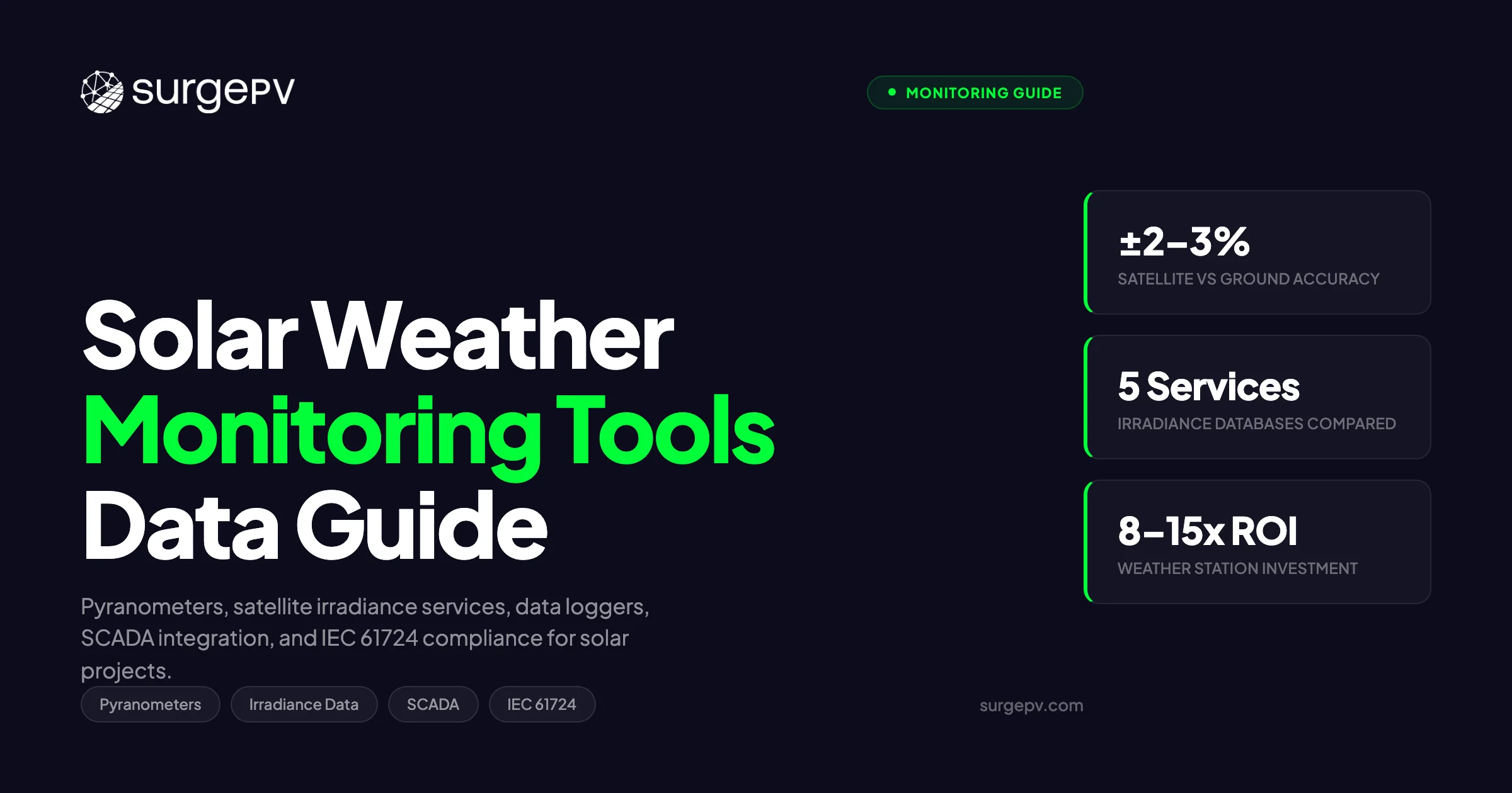
Solar weather monitoring tools include pyranometers (1% accuracy, €2,000–€5,000), silicon reference cells (2% accuracy, €500–€1,000), and satellite-based services like Solcast and SolarAnywhere (no hardware, 5% accuracy). Ground stations provide bankable data; satellite services suffice for preliminary assessments.
A 20 MW solar plant in southern Spain reported a performance ratio of 82% for Q3 2025. On paper, that looked acceptable. But when an independent engineer compared the plant’s satellite-derived irradiance data against a newly installed Class A pyranometer, the actual in-plane irradiance was 6.3% higher than the satellite estimate. The corrected PR dropped to 77.1%, revealing an inverter string failure that had gone undetected for four months. The revenue loss: approximately €48,000. Also see: Spain net metering.
Solar weather monitoring tools include pyranometers (1% accuracy, €2,000–€5,000), silicon reference cells (2% accuracy, €500–€1,000), and satellite-based services like Solcast and SolarAnywhere (no hardware, 5% accuracy). Ground stations provide bankable data; satellite services suffice for preliminary assessments.
Solar weather monitoring tools include pyranometers (1% accuracy, €2,000–€5,000), silicon reference cells (2% accuracy, €500–€1,000), and satellite-based services like Solcast and SolarAnywhere (no hardware, 5% accuracy). Ground stations provide bankable data; satellite services suffice for preliminary assessments.
That gap between satellite data and ground truth is where weather monitoring pays for itself. Every performance metric in solar, from performance ratio to specific yield to degradation rate, depends on accurate irradiance and temperature measurements. Get the weather data wrong and you cannot tell whether a system is underperforming, overperforming, or simply measured incorrectly.
This guide covers the full weather monitoring stack for solar projects in 2026: measurement hardware, satellite irradiance services, data loggers, SCADA integration, IEC compliance, and how weather data feeds into design, forecasting, and O&M.
TL;DR — Solar Weather Monitoring Tools 2026
Solar weather monitoring spans hardware (pyranometers, temperature sensors, anemometers, data loggers) and software (satellite irradiance services, SCADA platforms, forecasting tools). Thermopile pyranometers remain the gold standard at 1-2% daily uncertainty; satellite services like Solargis achieve 2-4% annual bias in favorable climates but can miss 5-10% in complex terrain. IEC 61724 defines three monitoring classes that determine minimum instrumentation. A basic weather station costs $1,500-$3,000; bankable-grade setups run $15,000-$30,000. Every solar project above 100 kW should have on-site weather measurement for accurate PR tracking and fault detection.
In this guide:
- Latest 2026 updates in solar weather monitoring technology and standards
- Why weather monitoring matters: PR calculation, warranty claims, and bankable yield verification
- Types of solar weather monitoring equipment, with head-to-head comparison tables
- Satellite irradiance services vs. ground measurements: Solargis, CAMS, NASA POWER, Meteonorm, PVGIS
- Weather station configurations by project size (residential, commercial, utility-scale)
- Data logger and SCADA integration workflows
- IEC 61724 compliance requirements by monitoring class
- How weather data feeds into solar design software and financial modeling
- Cost analysis with equipment pricing tables
- Common mistakes in solar weather monitoring and how to avoid them
Latest Updates: Solar Weather Monitoring 2026
The weather monitoring space for solar has seen meaningful product launches and standard updates since mid-2025. Here is the current status of what matters for project developers, O&M teams, and engineering firms.
Solar Weather Monitoring — Key Developments March 2026
| Development | Status | Impact |
|---|---|---|
| IEC 61724-1:2021 Amendment 1 | Published (late 2025) | Clarified soiling measurement integration and data quality flagging rules |
| Solargis API v3.5 | Live | Sub-hourly (15-min) satellite irradiance for Europe, MENA, and APAC; reduced latency to under 30 minutes |
| CAMS Radiation Service v4.5 | Live (Feb 2026) | Improved aerosol optical depth modeling; GHI RMSE reduced by approximately 8% vs. v4.0 |
| Kipp & Zonen SMP series refresh | Shipping | New SMP22 with digital RS-485 output and built-in tilt sensor; replaces legacy analog models |
| Hukseflux SR30 firmware update | Available | Added automatic soiling detection algorithm for in-plane sensors |
| Campbell Scientific CR6 firmware 14 | Available | Native MQTT support for direct cloud integration without middleware |
| ISO 9060:2018 reclassification | In effect | Replaced “first class” and “secondary standard” with Class A, B, C designations |
What Changed Since 2024
Satellite data got faster. Solargis and SolarAnywhere both now offer 15-minute resolution satellite irradiance with under 30-minute latency. This makes satellite data viable for near-real-time performance monitoring, not just historical analysis or prospecting.
Soiling measurement entered the standard. The IEC 61724-1 amendment formally addresses how soiling ratio measurements should be collected, filtered, and reported alongside irradiance data. This closes a long-standing gap where soiling losses were estimated rather than measured.
Digital pyranometers are replacing analog. The shift from analog (4-20 mA or millivolt) to digital (RS-485, Modbus RTU) pyranometer outputs simplifies data logger wiring and reduces signal noise on long cable runs. Kipp & Zonen’s new SMP22 and Hukseflux’s SR30 both support digital output natively. For UK-specific information, see Battery Solar System Design UK.
Pro Tip
If you are specifying a new weather station in 2026, choose pyranometers with native digital (Modbus RTU) output. The upfront cost premium is $200-$400 per sensor, but you eliminate the need for analog-to-digital signal converters and reduce commissioning time. Most modern data loggers (Campbell CR1000X, CR6, SMA Data Manager M) support Modbus RTU natively.
Why Weather Monitoring Matters for Solar Projects
Weather monitoring is not optional instrumentation. It is the measurement backbone that supports four commercial functions in every solar project.
1. Performance Ratio Calculation
Performance ratio is the primary metric for assessing whether a solar plant is operating as expected. The formula is straightforward:
PR = Actual Energy Output / (Reference Irradiance x Rated Capacity x Time)
The reference irradiance in that equation comes directly from on-site weather measurements. If the irradiance data is inaccurate by 5%, the calculated PR shifts by the same margin, and that shift can hide real equipment faults or, conversely, trigger false alarms.
IEC 61724-1 specifies the measurement instruments required for each monitoring class. Without compliant weather data, PR calculations are technically non-standard and may not be accepted by investors, lenders, or independent engineers during due diligence.
2. Bankable Yield Verification
Project finance lenders require P50 and P90 yield estimates based on validated irradiance data. The standard practice is to combine 10-20 years of satellite irradiance history with at least 12 months of on-site ground measurements. The ground data corrects systematic satellite bias for the specific site.
Without on-site measurement, lenders apply higher uncertainty margins. On a 10 MW project with a P50 yield of 16,000 MWh/year, an extra 2% uncertainty margin can reduce the P90 estimate by 300-400 MWh/year, directly impacting debt sizing and project IRR.
3. Warranty Claims and Contractual Disputes
EPC performance guarantees and O&M contracts typically reference PR thresholds calculated from on-site weather data. When a system underperforms and the developer invokes a warranty claim, the quality of the weather measurement becomes a legal question.
A plant with only satellite irradiance data will face pushback from the EPC contractor, who can argue that the satellite estimate was inaccurate for the site. A plant with IEC 61724 Class A weather monitoring and calibrated instruments has defensible data that holds up in arbitration.
4. O&M Fault Detection
Real-time weather data, combined with inverter telemetry, enables condition-based maintenance. If irradiance is 800 W/m² and module temperature is 45 degrees C, the expected output from a specific string is calculable within tight bounds. When actual output deviates beyond the threshold, the SCADA system generates an alarm.
Without on-site weather data, O&M teams rely on comparing strings against each other (relative analysis), which fails to detect system-wide losses like soiling, tracker misalignment, or transformer efficiency degradation.
Key Takeaway
Weather monitoring is not a monitoring cost. It is a risk mitigation investment. On a 5 MW commercial plant, the difference between satellite-only and ground-measured irradiance data typically changes the bankable yield estimate by 400-800 MWh/year, which translates to $20,000-$60,000 in annual revenue certainty depending on the PPA rate.
Types of Solar Weather Monitoring Equipment
Solar weather stations combine multiple sensors to capture the environmental conditions that affect PV output. Here is a breakdown of each sensor type, what it measures, and when you need it.
Pyranometers: The Core Irradiance Sensor
A pyranometer measures solar irradiance (GHI, or global horizontal irradiance) in watts per square meter. It is the single most important sensor in any solar weather station. For a deeper explanation of GHI, DNI, and DHI and how they affect system design, see the solar irradiance GHI, DNI, and DHI guide.
There are two main pyranometer technologies:
Thermopile pyranometers use a thermopile sensor under a glass dome. They respond to the full solar spectrum (300-2800 nm) and are the reference instrument for meteorological-grade measurement. ISO 9060:2018 classifies them as Class A (formerly “secondary standard”), Class B (formerly “first class”), or Class C.
Silicon-cell pyranometers (also called reference cells or photodiode pyranometers) use a silicon photodiode. They are faster-responding and cheaper, but only respond to approximately 350-1100 nm. This spectral limitation introduces errors of 3-5% under overcast skies, low sun angles, and high-diffuse conditions.
Pyranometer Comparison: Thermopile vs. Silicon Cell
| Characteristic | Thermopile (Class A) | Thermopile (Class B) | Silicon Cell |
|---|---|---|---|
| Spectral range | 300-2800 nm | 300-2800 nm | 350-1100 nm |
| Daily uncertainty | 1-2% | 2-3% | 3-5% |
| Annual uncertainty | Under 1% (calibrated) | 1-2% | 2-5% |
| Response time | 5-18 seconds | 5-18 seconds | Under 1 ms |
| Zero offset (thermal) | Under 2 W/m² | Under 7 W/m² | None |
| Temperature dependence | Under 1% (-20 to +50 C) | Under 2% | 2-4% |
| Typical cost | $2,500-$5,000 | $1,200-$2,500 | $300-$800 |
| Calibration interval | 2 years | 2 years | 1-2 years |
| IEC 61724 Class A compliant | Yes | Conditional | No |
| Best use case | Bankable monitoring, utility-scale | Commercial monitoring | Residential, cost-sensitive projects |
Example models:
- Class A thermopile: Kipp & Zonen SMP22, Hukseflux SR30, EKO MS-80
- Class B thermopile: Kipp & Zonen SMP11, Hukseflux SR20, EKO MS-60
- Silicon cell: Kipp & Zonen SMP3, LI-COR LI-200R, Apogee SP-510
Reference Cells
Reference cells are small PV cells (typically monocrystalline silicon) mounted in the plane of the array. They measure in-plane irradiance with a spectral response that closely matches the PV modules. This makes them useful for direct PR calculation because spectral mismatch errors between the sensor and the modules are minimized.
See also: how solar panels work.
However, reference cells are not ISO 9060 compliant and are not accepted as the sole irradiance sensor for IEC 61724 Class A monitoring. They are commonly used alongside a thermopile pyranometer: the pyranometer provides the standard-compliant GHI measurement, while the reference cell provides a module-matched POA (plane of array) irradiance reading.
Temperature Sensors
Two temperature measurements matter for solar performance:
Module temperature — measured with a PT100 or PT1000 RTD sensor bonded to the back of a representative module. Module temperature directly affects PV cell efficiency. For crystalline silicon, the temperature coefficient is approximately -0.35% to -0.45% per degree C above STC (25 degrees C).
Ambient temperature — measured with a shielded, ventilated temperature sensor (typically a PT100 in a Stevenson screen or radiation shield). Ambient temperature is used in thermal models that estimate module temperature when direct measurement is unavailable.
Pro Tip
Place back-of-module temperature sensors on at least two modules in different array positions (center and edge). Module temperature can vary by 5-10 degrees C across a large array due to wind exposure differences. Using a single sensor in a sheltered location will underestimate average array temperature and overestimate expected output.
Anemometers and Wind Sensors
Wind speed and direction affect module temperature through convective cooling. An anemometer is required for IEC 61724 Class A monitoring and recommended for Class B.
Cup anemometers are the traditional choice. Ultrasonic anemometers (no moving parts) have become the preferred option for solar applications due to lower maintenance and better accuracy at low wind speeds (under 2 m/s), which is the range that matters most for module cooling calculations.
Typical mounting height for solar weather stations is 2 meters above the top of the array, or 10 meters for sites that also supply meteorological data to grid operators.
Rain Gauges and Soiling Sensors
Rain gauges (tipping bucket type) record precipitation. The primary value for solar is indirect: rain events correlate with soiling loss reduction. After extended dry periods, accumulated dust and pollen reduce module output by 2-7% depending on location and tilt angle.
Soiling sensors (such as the Kipp & Zonen DustIQ or the Atonometrics soiling station) directly measure the optical transmission loss from surface contamination. The IEC 61724-1:2021 amendment now formally includes soiling measurement as part of the monitoring data set for Class A systems.
Complete Equipment Comparison Table
| Sensor | What It Measures | Required By IEC 61724 | Typical Cost | Key Specification |
|---|---|---|---|---|
| Thermopile pyranometer (Class A) | GHI or POA irradiance | Class A: required | $2,500-$5,000 | Under 2% daily uncertainty |
| Thermopile pyranometer (Class B) | GHI or POA irradiance | Class B: required | $1,200-$2,500 | Under 3% daily uncertainty |
| Silicon-cell pyranometer | GHI or POA irradiance | Class C: acceptable | $300-$800 | 3-5% daily uncertainty |
| Reference cell | POA irradiance (module-matched) | Supplementary | $400-$1,200 | Spectral match to PV modules |
| Module temperature sensor (PT100) | Back-of-module temperature | Class A, B: required | $50-$200 | ±0.3 C accuracy |
| Ambient temperature sensor | Air temperature | Class A: required | $100-$400 | Ventilated radiation shield |
| Anemometer (cup or ultrasonic) | Wind speed and direction | Class A: required | $300-$1,500 | ±0.5 m/s accuracy |
| Rain gauge (tipping bucket) | Precipitation | Recommended | $200-$600 | 0.2 mm resolution |
| Soiling sensor | Optical soiling ratio | Class A: recommended (2021 amendment) | $2,000-$5,000 | ±1% transmission accuracy |
| Data logger | Data collection and transmission | All classes | $1,000-$5,000 | Modbus, MQTT, cellular |
Satellite Irradiance Services vs. Ground Measurements
Every solar project uses satellite irradiance data at some point, whether during prospecting, yield assessment, or operational monitoring. The question is not whether to use satellite data, but when ground measurements are also needed and how the two sources should be combined.
How Satellite Irradiance Works
Satellite irradiance services derive surface solar radiation from geostationary weather satellite imagery (Meteosat, GOES, Himawari). Algorithms like Heliosat analyze cloud cover, aerosol loading, and atmospheric conditions to estimate GHI, DNI, and DHI at the surface. The data is typically available at 15-minute to 1-hour resolution with spatial grids of 1-5 km.
The accuracy depends heavily on geography. Clear-sky-dominated regions (deserts, Mediterranean) show lower satellite bias because clouds are the dominant error source and there are fewer of them. Coastal zones, mountainous terrain, and regions with high aerosol variability (Southeast Asia, parts of India, West Africa) show higher deviations. Also see: Best Solar Design Software India. For the latest details on India, see 5kW Solar Panel Price in India. For Africa-specific compliance details, see Africa solar compliance.
Satellite Service Comparison
| Service | Provider | Coverage | Temporal Resolution | Spatial Resolution | Annual GHI Bias (Typical) | RMSE (Hourly) | Cost |
|---|---|---|---|---|---|---|---|
| Solargis | Solargis s.r.o. | Global (60 N to 50 S) | 15 min (v3.5) | 1-2 km | ±2-4% | 15-20% | $$ (subscription) |
| SolarAnywhere | Clean Power Research | Americas, Europe, APAC | 30 min | 1 km (US), 4 km (intl) | ±2-5% | 15-22% | $$ (subscription) |
| CAMS Radiation Service | Copernicus/ECMWF | Global | 1 min to 1 hour | ~5 km | ±3-7% | 18-25% | Free |
| NASA POWER | NASA LaRC | Global | Hourly / Daily | ~50 km (0.5 degree) | ±5-10% | 20-30% | Free |
| PVGIS | European Commission JRC | Europe, Africa, parts of Asia | Hourly (TMY) | ~3-5 km | ±3-6% | 18-25% | Free |
| Meteonorm | Meteoeotest | Global | Hourly (synthetic) | Station-interpolated | ±3-6% | N/A (synthetic) | $ (license) |
Key Takeaway
For pre-development site screening and residential system design, satellite irradiance data from Solargis, PVGIS, or CAMS is sufficient. For commercial and utility-scale projects where yield accuracy directly affects financing terms, combine satellite data with at least 12 months of on-site ground measurements. The ground data corrects site-specific satellite bias (terrain shading, local aerosols, coastal effects) that satellite algorithms cannot resolve at their grid scale.
When Ground Measurements Are Required
The decision to install ground-based weather monitoring is driven by project economics and contractual requirements.
| Project Context | Satellite Only | Ground + Satellite |
|---|---|---|
| Residential (under 30 kW) | Sufficient | Not cost-justified |
| Commercial (30-500 kW) | Acceptable for design; PR monitoring benefits from ground data | Recommended for O&M contracts with PR guarantees |
| Utility-scale (over 500 kW) | Insufficient for financing | Required by most lenders and IEs |
| Projects with EPC PR guarantee | Risk of contractual disputes | Required for defensible PR calculation |
| Prospecting / pre-feasibility | Sufficient | Not applicable |
| Bankable yield assessment | Must be validated against ground data | 12+ months of on-site data required |
For a detailed comparison of [solar energy forecasting software](/blog/solar-energy-forecasting-software) that integrates both satellite and ground-measured data, see the dedicated guide. See our guide on Agricultural Solar Case Study for more.
Weather Station Configuration by Project Size
The instrumentation requirements scale with project size, contractual obligations, and monitoring class. Here is a practical guide to what each project tier needs.
Residential Systems (Under 30 kW)
Most residential solar installations do not include dedicated weather stations. Performance monitoring relies on inverter-reported data (AC output, DC voltage/current) and satellite irradiance for approximate yield comparison. See DC Bus Voltage Optimization for detailed guidance.
Minimum recommended setup: None beyond the inverter’s built-in monitoring. For homeowners who want more data, a consumer-grade weather station ($200-$500) with a pyranometer add-on provides useful context but is not commercially necessary.
When ground monitoring makes sense for residential: Portfolio monitoring. If a residential installer manages 500+ systems across a region, installing a handful of reference weather stations (one per microclimate zone) and applying the data across the portfolio improves fleet-level performance analytics at minimal per-system cost.
Commercial Systems (30 kW to 500 kW)
Commercial projects are where on-site weather monitoring starts to pay for itself. PR-based O&M contracts, lease agreements tied to production guarantees, and insurance requirements all benefit from defensible weather data.
Recommended setup:
| Component | Specification | Estimated Cost |
|---|---|---|
| Pyranometer | Class B thermopile (e.g., Kipp & Zonen SMP11) mounted in plane of array | $1,500 |
| Module temperature sensor | PT100 bonded to back of representative module | $100 |
| Ambient temperature sensor | PT100 in ventilated radiation shield | $300 |
| Data logger | Campbell CR310, SMA Data Manager M, or equivalent with Modbus input | $1,500 |
| Cellular modem | 4G/LTE modem for remote data transmission | $400 |
| Mounting hardware | Stainless steel mast, sensor arms, cable glands | $500 |
| Total | $4,300 |
Utility-Scale Systems (Over 500 kW)
Utility-scale plants require IEC 61724 Class A monitoring for bankable performance verification. Most lenders and independent engineers (IEs) require at least one fully instrumented weather station per 5-10 MW of capacity, plus additional satellite pyranometers distributed across the array.
Recommended setup (per weather station):
| Component | Specification | Estimated Cost |
|---|---|---|
| Primary pyranometer | Class A thermopile (e.g., Hukseflux SR30) — GHI | $3,500 |
| Secondary pyranometer | Class A thermopile — POA (in plane of array) | $3,500 |
| Reference cell | Monocrystalline Si — POA (module-matched) | $800 |
| Module temperature sensors | PT100 x 4 (distributed across array) | $400 |
| Ambient temperature sensor | PT100 in ventilated shield | $300 |
| Anemometer | Ultrasonic 2D (e.g., Gill MaxiMet) | $1,200 |
| Rain gauge | Tipping bucket, 0.2 mm resolution | $400 |
| Soiling sensor | DustIQ or equivalent | $3,500 |
| Data logger | Campbell CR1000X with Modbus, MQTT, SDI-12 | $3,000 |
| Cellular + Ethernet | Dual communication for redundancy | $600 |
| UPS / battery backup | 4-hour autonomy | $500 |
| Mounting structure | Galvanized steel mast, 3 m | $800 |
| Total per station | $18,500 |
For a 20 MW plant, expect 2-4 weather stations plus 4-8 distributed satellite pyranometers. Total weather monitoring infrastructure cost: $50,000-$90,000, representing 0.3-0.5% of total plant CAPEX.
Pro Tip
On utility-scale plants with single-axis trackers, mount the POA pyranometer on a dedicated tracker that follows the same algorithm as the production trackers. Do not mount it on a fixed structure and calculate the expected tracker angle. Mechanical backlash and tracking algorithm differences between ideal and actual positions can introduce 1-3% irradiance measurement error.
Data Logger and SCADA Integration
The weather station hardware collects the measurements. The data logger aggregates, timestamps, and transmits them. Getting this integration right determines whether weather data is actually usable for performance analysis or sits in an inaccessible silo. Also see: Us Residential Solar Market Trends 2026.
Data Logger Functions
A solar weather station data logger performs five tasks:
- Signal acquisition — reads analog (mV, 4-20 mA) or digital (Modbus RTU, SDI-12) sensor outputs at configured intervals (typically 1-second scan, 1-minute average)
- Data processing — calculates averages, min/max, standard deviation over the reporting interval
- Quality flagging — marks data points that fall outside physical limits (e.g., irradiance over 1,500 W/m² or negative values at night)
- Local storage — buffers data for 30-90 days in case of communication failures
- Transmission — sends data to the SCADA platform or cloud server via cellular, Ethernet, or satellite link
Common Data Logger Models for Solar
| Logger | Manufacturer | Channels | Communication | Protocol Support | Typical Use | Price Range |
|---|---|---|---|---|---|---|
| CR1000X | Campbell Scientific | 32 analog + 4 pulse | Ethernet, cellular, Wi-Fi | Modbus, MQTT, SDI-12, TCP/IP | Utility-scale reference | $3,000-$4,500 |
| CR6 | Campbell Scientific | 24 analog + 4 pulse | Same as CR1000X | Same + native MQTT (fw 14) | Utility-scale, research | $3,500-$5,000 |
| CR310 | Campbell Scientific | 6 analog + 2 pulse | Cellular, Ethernet | Modbus, SDI-12 | Commercial systems | $1,200-$1,800 |
| Data Manager M | SMA | Digital only (Modbus) | Ethernet, cellular | Modbus TCP, SunSpec | SMA inverter ecosystems | $1,500-$2,500 |
| meteocontrol blue’Log X-6000 | meteocontrol | Mixed analog + digital | Ethernet, cellular | Modbus, IEC 61850 | Large commercial, utility | $2,500-$4,000 |
| SunStar-MET | Trimark | 16 analog + digital | Ethernet, cellular, satellite | DNP3, Modbus, MQTT | Utility-scale SCADA | $4,000-$6,000 |
SCADA Integration Architecture
For utility-scale plants, the weather station data logger feeds into the plant’s SCADA (Supervisory Control and Data Acquisition) system alongside inverter, meter, and tracker telemetry. The standard communication path looks like this:
Sensors → Data Logger → Plant-Level SCADA → Cloud Platform / Central Monitoring
Communication protocols commonly used:
- Modbus TCP/RTU — the most common protocol for connecting sensors to loggers and loggers to local SCADA
- MQTT — increasingly adopted for logger-to-cloud communication due to low bandwidth and native support for intermittent connectivity
- DNP3 — used when the solar plant interfaces with utility-grade SCADA systems for grid dispatch
- IEC 61850 — required by some European utilities for substation and plant-level communication
- OPC UA — used for integration with enterprise SCADA platforms (OSIsoft PI, GE Proficy)
Data Quality and Gap Filling
Even well-maintained weather stations experience data gaps. Sensor failures, communication outages, and power interruptions all contribute. IEC 61724-1 allows gap filling using correlated data sources:
- Gaps under 1 hour: interpolate from adjacent measurements
- Gaps of 1-24 hours: fill from a correlated satellite source or nearby reference station
- Gaps over 24 hours: flag the period and exclude from PR calculations; do not interpolate
For solar performance monitoring platforms, automated gap-filling algorithms are standard. The better platforms flag filled data distinctly from measured data, which matters for bankable reporting.
Design Solar Systems with Built-In Weather Intelligence
SurgePV integrates satellite irradiance data, TMY datasets, and hourly weather simulation directly into system design and financial modeling.
Book a DemoNo commitment required · 20 minutes · Live project walkthrough
For a direct comparison, see Arka 360 vs SurgePV.
IEC 61724 Compliance Requirements
IEC 61724 is the international standard that governs PV system performance monitoring. Understanding its requirements is necessary for specifying weather stations that produce data acceptable to lenders, IEs, and contractual counterparties.
The Three Monitoring Classes
| Requirement | Class A | Class B | Class C |
|---|---|---|---|
| Irradiance sensor | Class A thermopile (ISO 9060) | Class B thermopile | Silicon cell acceptable |
| In-plane irradiance | Required (POA pyranometer) | Required | Optional |
| Module temperature | Required (direct measurement) | Required | Estimated from ambient acceptable |
| Ambient temperature | Required (ventilated shield) | Recommended | Optional |
| Wind speed | Required | Recommended | Not required |
| Data sampling interval | Under 1 minute scan | Under 5 minute scan | Under 15 minute scan |
| Reporting interval | Under 15 minutes | Under 15 minutes | Under 60 minutes |
| Data availability target | Over 99% | Over 97% | Over 95% |
| Typical application | Utility-scale, bankable reporting | Commercial, O&M contracts | Residential, fleet monitoring |
Performance Ratio Under IEC 61724
The standard defines Performance Ratio as:
PR = Y_f / Y_r
Where:
- Y_f (final yield) = net AC energy output / rated DC power (kWh/kWp)
- Y_r (reference yield) = in-plane irradiation / reference irradiance at STC (hours)
Temperature-corrected PR adjusts for the difference between actual module temperature and the STC reference temperature (25 degrees C). This gives a cleaner measure of system health independent of seasonal temperature variation.
For a complete walkthrough of PR calculation and interpretation, see the solar performance ratio guide.
Compliance Tips
Calibrate on schedule. Pyranometer calibration drifts over time. ISO 9060 recommends recalibration every 2 years for thermopile sensors. If your calibration lapses, the data collected during the lapsed period is technically non-compliant, even if the sensor was functioning correctly.
Document everything. IEC 61724 requires metadata including sensor model, serial number, calibration date, mounting angle, height, and orientation. Missing metadata can invalidate an otherwise perfect data set during an IE review.
Use quality flags. Mark nighttime data, rain events, sensor cleaning events, and any maintenance interventions. Automatic quality flagging at the data logger level (sensor limits, statistical outlier detection) saves significant time during post-processing.
How Weather Data Feeds into Solar Design and Financial Modeling
Weather data does not exist in isolation. It is an input to every stage of the solar project lifecycle, from site prospecting through 25-year financial modeling.
Site Prospecting and Resource Assessment
At the prospecting stage, satellite irradiance data (typically from Solargis, PVGIS, or CAMS) provides the initial GHI and DNI estimates for a site. These values determine whether a site is viable and what approximate yield can be expected.
Solar design software like SurgePV pulls TMY (Typical Meteorological Year) data sets that represent long-term average weather conditions for a location. TMY data includes hourly values for GHI, DNI, DHI, ambient temperature, wind speed, and humidity, compiled from 10-20 years of satellite and ground station records.
System Design and Shading Analysis
During system design, weather data drives two calculations:
- Irradiance transposition — converting GHI data to plane-of-array (POA) irradiance based on array tilt, azimuth, and tracking configuration
- Shading loss quantification — solar shadow analysis software uses hourly sun position data (derived from location and time) combined with 3D site models to calculate the irradiance reduction from nearby obstructions throughout the year
For a deeper look at how shading analysis tools use weather and sun-position data, see the solar shading analysis tools guide.
Yield Simulation and Financial Modeling
The generation and financial tool in a solar design platform takes the POA irradiance profile and applies module-level losses (temperature, soiling, mismatch, wiring, inverter clipping) to produce an annual yield estimate.
Weather data uncertainty feeds directly into the P50/P90 yield spread:
| Uncertainty Source | Typical Range | Impact on P90 |
|---|---|---|
| Satellite irradiance inter-annual variability | 3-6% | Dominant for most sites |
| Satellite-to-ground bias correction | 1-4% | Reduced with on-site data |
| TMY representativeness | 1-3% | Higher for short satellite records |
| Irradiance transposition model | 1-2% | Higher for high-tilt and tracking systems |
| Temperature model uncertainty | 0.5-1.5% | Higher in hot, low-wind sites |
| Combined (RSS) | 4-8% | Determines P90/P50 ratio |
A well-characterized site with 12+ months of ground data and 15+ years of satellite history can reduce total irradiance uncertainty to 3-4%, which narrows the P50-P90 gap and improves bankable yield.
Pro Tip
When preparing a bankable yield report, always state the irradiance data source, the years of record, the satellite-to-ground correction method, and the uncertainty assumptions. Independent engineers will challenge any yield estimate where the weather data provenance is unclear. Use Solargis or SolarAnywhere time series with explicit bias-correction against at least 12 months of on-site Class A or Class B pyranometer data.
Operational Monitoring and Forecasting
Once a plant is operational, weather data shifts from a design input to a real-time monitoring input. The monitoring platform ingests live irradiance and temperature measurements and compares actual output against the expected output for those conditions.
This comparison powers:
- Performance ratio tracking — daily, weekly, and monthly PR trends identify degradation and seasonal losses
- Alarm generation — deviations beyond threshold trigger O&M tickets
- Day-ahead yield forecasting — NWP (numerical weather prediction) models and satellite nowcasting feed short-term production forecasts to grid operators and energy traders
- Long-term degradation analysis — weather-normalized annual yield trends isolate true module degradation from inter-annual weather variability
For a comparison of PV performance monitoring software that integrates weather data, see the dedicated review.
Choosing the Right Weather Monitoring Setup
The right monitoring configuration depends on four factors: project size, contractual requirements, budget, and data integration needs. Here is a decision framework.
Decision Matrix by Project Type
| Factor | Residential (under 30 kW) | Commercial (30-500 kW) | Utility-Scale (over 500 kW) |
|---|---|---|---|
| Primary monitoring goal | Basic production tracking | PR-based O&M, lease compliance | Bankable performance verification |
| Irradiance source | Satellite only | Ground + satellite | Ground (Class A) + satellite |
| Minimum IEC 61724 class | Class C (if any) | Class B | Class A |
| Pyranometer type | None or silicon cell | Class B thermopile | Class A thermopile + reference cell |
| Temperature measurement | Inverter-estimated | Module + ambient PT100 | Module (x4) + ambient PT100 |
| Wind measurement | Not needed | Optional | Required |
| Data logger | Inverter-integrated | Standalone basic logger | Standalone with SCADA integration |
| Communication | Wi-Fi via inverter | Cellular | Cellular + Ethernet (redundant) |
| Estimated weather station cost | $0-$500 | $3,000-$8,000 | $15,000-$30,000 per station |
| Number of stations | 0-1 (portfolio reference) | 1 | 1 per 5-10 MW |
Special Considerations
Bifacial module installations need a rear-side irradiance sensor (either a downward-facing pyranometer or an albedometer) in addition to the standard POA sensor. Without rear irradiance measurement, bifacial gain cannot be verified against the design assumption. See Bifacial Solar Panel Design Guide for detailed guidance.
Tracker-equipped plants should mount at least one POA pyranometer on a tracker unit, not a fixed structure. The tracker’s actual pointing angle may differ from the ideal calculated angle due to mechanical tolerances, wind stow events, and tracking algorithm updates.
Snow-prone sites benefit from a heated pyranometer dome (available as an option on most Class A and Class B thermopiles). Unheated domes accumulate snow that blocks irradiance measurement, creating data gaps during the periods when snow-related production losses need to be quantified.
Desert and high-soiling sites should include a dedicated soiling sensor. In regions like the Middle East, India, or the US Southwest, soiling losses of 5-15% are common without regular cleaning. A soiling sensor provides the data to optimize cleaning schedules and verify the economic benefit of each cleaning cycle.
Cost Analysis: Weather Monitoring Equipment Pricing
Here is a consolidated pricing guide for weather monitoring equipment as of Q1 2026. All prices are approximate and represent typical procurement costs for commercial and utility-scale buyers.
Equipment Pricing Table
| Item | Budget Option | Mid-Range | Bankable Grade | Notes |
|---|---|---|---|---|
| Pyranometer (GHI) | $300-$500 (silicon cell) | $1,500-$2,500 (Class B) | $3,000-$5,000 (Class A) | Class A required for IEC 61724 Class A |
| Pyranometer (POA) | $300-$500 | $1,500-$2,500 | $3,000-$5,000 | Mount in plane of array |
| Reference cell | N/A | $400-$800 | $800-$1,200 | Module-matched spectral response |
| Module temp sensor (PT100) | $50-$80 | $80-$150 | $150-$200 | Order 2-4 per station |
| Ambient temp sensor + shield | $100-$200 | $200-$350 | $300-$500 | Ventilated shield recommended |
| Anemometer (cup) | $200-$400 | N/A | N/A | Moving parts, higher maintenance |
| Anemometer (ultrasonic) | N/A | $600-$1,000 | $1,000-$1,500 | No moving parts, preferred |
| Rain gauge | $150-$300 | $300-$500 | $500-$800 | Tipping bucket, heated option +$200 |
| Soiling sensor | N/A | N/A | $2,500-$5,000 | DustIQ, Atonometrics |
| Data logger | $500-$1,000 | $1,200-$2,500 | $3,000-$5,000 | Campbell, meteocontrol, Trimark |
| Cellular modem | $200-$400 | $400-$600 | $500-$800 | 4G/LTE, dual SIM option |
| Mounting structure | $200-$500 | $500-$800 | $800-$1,500 | Stainless or galvanized steel mast |
| Installation labor | $500-$1,000 | $1,000-$2,000 | $2,000-$4,000 | Includes cable routing and commissioning |
| Annual calibration | $200-$500 | $500-$1,000 | $1,000-$2,000 | Pyranometer recalibration every 2 years |
Total Station Cost Summary
| Configuration | Components | Total Cost (Installed) | Suitable For |
|---|---|---|---|
| Basic | Silicon pyranometer + module temp + basic logger | $1,500-$3,000 | Residential portfolios, cost-sensitive commercial |
| Commercial | Class B pyranometer + module/ambient temp + cellular logger | $4,000-$8,000 | Commercial (30-500 kW), O&M contracts |
| Utility standard | Class A pyranometer (GHI + POA) + reference cell + temp + anemometer + logger | $12,000-$20,000 | Utility-scale, lender requirements |
| Bankable premium | Above + soiling sensor + rain gauge + redundant communication + UPS | $18,000-$30,000 | Bankable monitoring, independent engineer compliance |
Key Takeaway
Weather monitoring equipment represents 0.2-0.5% of total plant CAPEX for utility-scale projects. The ROI comes from improved yield certainty (narrower P50-P90 spread), faster fault detection (reduced energy loss), and defensible data for warranty claims and contractual disputes. On a 10 MW plant, better weather data is worth $30,000-$80,000 per year in reduced revenue uncertainty alone.
Common Mistakes in Solar Weather Monitoring
After reviewing hundreds of solar weather monitoring installations across Europe and MENA, these are the errors that appear most frequently.
1. Mounting the Pyranometer on a Fixed Structure at a Tracker Site
If the array uses single-axis trackers, the POA irradiance sensor must track with the array. A fixed-mount sensor measures a different irradiance plane than the modules, introducing systematic errors of 3-8% during morning and afternoon hours when the angular difference is greatest.
2. Single Module Temperature Sensor on a Large Array
Module temperature varies by 5-12 degrees C across a large array depending on wind exposure, mounting height, and row position. A single sensor on a wind-exposed edge module will read lower than the array average. Place sensors on at least 2-4 representative modules and average the readings.
3. Ignoring Pyranometer Calibration Schedules
Thermopile pyranometer sensitivity drifts by 0.5-1.5% per year. After 4-5 years without recalibration, the cumulative drift can reach 3-5%, which directly biases every PR calculation that uses that sensor. Set calendar reminders and budget for biennial recalibration ($300-$700 per sensor including shipping).
4. Relying on Silicon-Cell Pyranometers for Bankable Data
Silicon-cell sensors are adequate for basic monitoring but introduce spectral errors under diffuse-dominated conditions. An independent engineer reviewing a bankable yield report will flag silicon-cell data as non-compliant with IEC 61724 Class A. For any project involving lender due diligence, use Class A thermopile pyranometers.
5. No Data Logger Backup During Communication Outages
If the data logger transmits directly to a cloud platform without local buffering, a cellular outage results in permanent data loss. Specify loggers with at least 30 days of local storage. The Campbell CR1000X and CR6 both support expandable microSD storage. Lost irradiance data during a PR assessment period can invalidate an entire quarterly report.
6. Placing the Weather Station in a Shaded Location
This sounds obvious, but it happens. Weather stations placed near transformer buildings, fence lines, or at the array periphery where morning or evening shading occurs will record lower irradiance than the array receives. The station should have an unobstructed horizon from sunrise to sunset throughout the year.
7. Not Leveling the GHI Pyranometer
A GHI pyranometer must be perfectly horizontal (within 0.1 degrees). A tilt of 1 degree introduces a cosine error of approximately 1.5% at high solar zenith angles. Use a precision bubble level during installation and verify seasonally, as thermal expansion and wind vibration can shift the mounting over time.
8. Using Satellite Data Without Site-Specific Correction
Satellite irradiance services are regional products. They do not account for local horizon shading, micro-climate effects (coastal fog, valley inversions), or terrain reflectance. Applying raw satellite data to a site in a mountain valley or coastal zone without ground-truth correction can overestimate irradiance by 5-10%.
Pro Tip
Create a weather station commissioning checklist that covers: sensor serial numbers and calibration dates, mounting angles verified with an inclinometer, data logger sampling and averaging intervals confirmed, communication test (local and remote), and a 48-hour data quality review before the station is considered operational. This upfront rigor prevents data quality problems that are expensive to diagnose months later.
Conclusion
Solar weather monitoring is the measurement foundation for every performance metric, financial model, and O&M decision in a solar project. Getting it right is not complicated, but it requires deliberate choices about instrumentation, data standards, and integration.
Three actions to take:
-
Match your monitoring class to your project needs. Residential portfolios can work with satellite data and fleet reference stations. Commercial projects need at least a Class B weather station. Utility-scale plants require Class A instrumentation with SCADA integration.
-
Combine satellite and ground data. Neither source is sufficient alone. Use satellite for long-term resource assessment and ground measurements for bias correction, real-time monitoring, and bankable verification. For system design, use solar design software that integrates TMY data directly into yield simulation and solar proposal software workflows.
-
Budget for maintenance. A weather station is not a set-and-forget installation. Biennial pyranometer calibration, monthly visual inspections, and quarterly data quality audits are the minimum. The cost of maintaining a weather station is a fraction of the cost of making decisions with bad data.
Frequently Asked Questions
What weather monitoring equipment do solar farms need?
Solar farms require, at minimum, a Class A or secondary standard pyranometer for global horizontal irradiance (GHI) measurement, a back-of-module temperature sensor, an ambient temperature sensor, and a data logger with SCADA connectivity. Utility-scale plants above 5 MW typically add an anemometer, rain gauge, and a second in-plane pyranometer for redundancy. IEC 61724-1 specifies the minimum instrumentation requirements based on system class, with Class A being the most stringent for bankable performance monitoring. For Global-specific compliance details, see Global net-metering-by-country.
How does weather data improve solar performance monitoring?
Weather data is the denominator in the performance ratio (PR) equation. By comparing actual energy output against the expected yield calculated from measured irradiance and temperature, operators can detect underperformance, soiling losses, inverter faults, and degradation. Without on-site weather data, PR calculations rely on satellite estimates with 3-8% uncertainty, which can mask real equipment problems. Continuous weather monitoring lets O&M teams set alarm thresholds and trigger corrective maintenance within hours rather than weeks.
What is a pyranometer and why do solar projects need one?
A pyranometer is a sensor that measures global horizontal irradiance (GHI) in watts per square meter. Solar projects need pyranometers to calculate performance ratio per IEC 61724, validate satellite irradiance models, and provide bankable production evidence for investors and lenders. Thermopile pyranometers (ISO 9060 Class A) offer the highest accuracy at 1-2% daily uncertainty. Silicon-cell pyranometers cost less but introduce spectral errors of 3-5% under non-standard sky conditions.
How accurate are satellite irradiance services compared to ground measurements?
Satellite irradiance services like Solargis report annual GHI bias of plus or minus 2-4% for flat terrain with clear-sky-dominated climates. In mountainous, coastal, or high-aerosol regions, satellite bias can reach 5-10%. Ground-based Class A pyranometers achieve under 2% annual uncertainty when properly maintained. CAMS (Copernicus) provides free hourly data with approximately 4-7% RMSE, while NASA POWER shows 5-10% RMSE depending on region. For bankable-grade yield assessments, lenders typically require at least 12 months of on-site ground measurements to validate satellite data.
What is the IEC 61724 standard for solar monitoring?
IEC 61724 is the international standard for photovoltaic system performance monitoring. It defines three monitoring classes: Class A (highest accuracy, required for utility-scale bankable monitoring), Class B (commercial systems), and Class C (basic residential). The standard specifies instrument types, measurement intervals, data quality filters, and the formulas for performance ratio, reference yield, and specific yield. IEC 61724-1 covers data collection and exchange, while IEC 61724-2 covers capacity evaluation and IEC 61724-3 addresses energy evaluation.
How much does a solar weather monitoring station cost?
A basic weather station with a silicon-cell pyranometer, temperature sensor, and entry-level data logger costs $1,500 to $3,000. A commercial-grade station with a Class B thermopile pyranometer, module temperature sensor, ambient temperature sensor, anemometer, and cellular data logger runs $5,000 to $12,000. A full bankable-grade station with redundant Class A pyranometers, rain gauge, soiling sensor, and SCADA-integrated logger costs $15,000 to $30,000. Annual calibration and maintenance adds $500 to $2,000 depending on instrumentation level.